
As we drove from the village of Drelaj toward Leqinat, the starting point for the third day of the Peaks of the Balkans trek, my heart sunk a bit. We were rolling over rough dirt roads, climbing higher and higher into the mountains and I couldn’t help but feel like I was cheating. The Belgian men I had met were going to spend the day hiking along the section that I just bypassed by riding in a four-wheel drive. Was I really going to get the full Peaks of the Balkans experience by skipping entire legs of the route?
A few hours later, as I huffed and puffed my way through tall grass on an almost non-existent path, I felt foolish for thinking I was missing out.
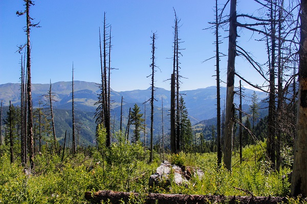
It was sunny but cool as we started off, but I immediately felt a burn in my calves as we headed steeply uphill – zig-zagging back and forth did little to ease the steepness. We reached a burned out forest before descending a bit toward the first of two lakes, known as Liqeni i Kucishtes. As we rounded the lake near the shore, it was fairly flat so Mentor (my guide) urged me to pick up the pace as we had to make it to Babino Polje between 3:00 and 3:30 p.m. to meet our transportation to Plav. I tried, but the path was so narrow and the grass so high, I felt like I was tripping over my own two feet whenever I tried to go faster.

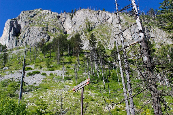
As we ascended up from the second lake, known as Liqeni i Drelajve, Mentor assured me that we just had one “not so steep” section remaining and then the rest of the day would be downhill. Well, I quickly realized that his definition of “not so steep” was not the same as mine! Not only was the next section steep, it was rocky, which made it impossible to fall into any kind of good rhythm.

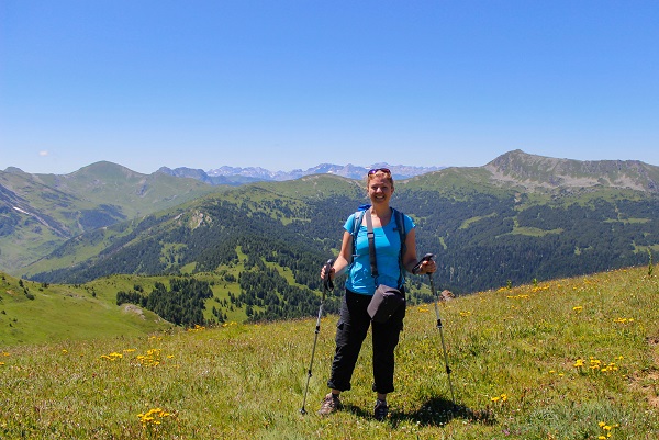
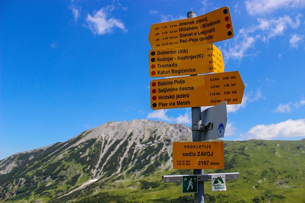
It was noon when we finally reached the top, which was also the border between Kosovo and Montenegro. It felt completely weird to just walk across the invisible border with no checkpoint, no lines, no passport stamps. Instead, Mentor carried a permit that allowed both of us to cross through the borders of these two countries and Albania at certain points around certain times of day, but in reality, no one was around to check. So my only evidence of setting foot in Montenegro (and Albania!) are my photos and the permit.
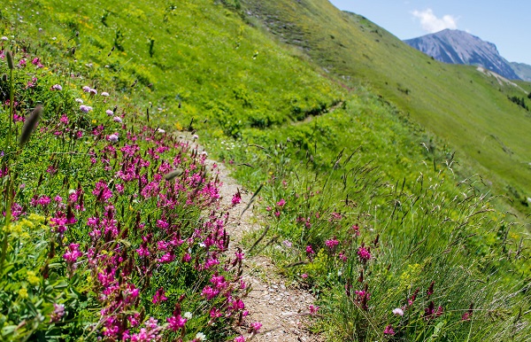

The next section was indeed downhill, but it was still on narrow paths through high grass, which meant it was still challenging. My left shoulder was throbbing from my ill-fitting day pack, the blisters on my small toes were rubbing despite being wrapped in band-aids and I just kept thinking about the fact that we still had three hours of hiking to go! Luckily, it was lunch time – a short break in the shade to eat the lunch that my host in Drelaj made me that morning – cornbread, cheese, cucumber and two hard-boiled eggs.
After a short uphill following lunch, we ran into a German couple resting from the sun in a tent at the top of a pass. They were the first people we had seen since leaving Leqinat more than four hours earlier!
From there, it was all downhill (in more ways than one!). As we left the German couple, we headed through a vast meadow following no apparent path whatsoever. I just did the best I could to follow Mentor’s lead through the tall grass, watching carefully where I was stepping, but slipping and turning my ankle over nonetheless. I wished I had hiking boots with more ankle support but on previous treks I never really needed them.
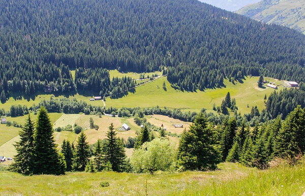
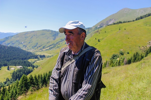
The meadow seemed to only get steeper and while I could see the village of Babino Polje down below, it didn’t seem to be getting any closer. Eventually, we ran into a shepherd and stopped to chat a bit. He spoke the Bosnian language, which as a Slavic language is more similar to Russian than Albanian is, so I could pick out bits and pieces of what he said. He was also wearing a Yankees cap, likely because, as we learned, 18,000 residents of nearby Plav now live in New York (leaving only 5,000 behind!). The shepherd directed us to an alleged shortcut, but it didn’t feel like a shortcut to me – it was even steeper and through higher grass than the route we had been following! By the time we reached Babino Polje, I was in so much pain I was close to tears.
We made it to Babino Polje around 3:15, which was right on schedule to meet our ride to Plav. Which would have been perfect if the ride had shown up. But it didn’t. So I killed the time waiting by taking selfies of me looking super happy to finally be done.

We waited until 4:00 and then started walking, hoping to catch a ride along the way (if we didn’t, it would be another five hours hike to Plav!). Luckily, we ran into the guy who runs a guesthouse in Babino Polje where Mentor has stayed in the past and he offered to drive us. And, miracle of all miracles, as we waited to depart his guesthouse, he offered us the wi-fi code and I was able to follow the end of the women’s final at Wimbledon on Twitter!
The adventure wasn’t over yet, though. As we started the drive toward Plav, we soon hit a major road bump – road construction! A crew was digging a huge hole in the road and a backhoe was completely blocking both lanes. We had to wait a good 20 minutes before we were able to pass and then had to dodge several more cars going the opposite direction as we followed the single lane, winding road most of the way to Plav.

A smile appeared on my face as we arrived in Plav. It was a real town with shops and markets (which meant I could treat myself to a cold Coke and some Kinder chocolate!) and I was staying in a brand new hotel with my own bathroom. Indeed, the hotel was so new that it wasn’t even totally finished. But my room was on the top floor and had a balcony with a nice view of the surrounding mountains, as well as wi-fi, a hot shower and even a hair dryer. After the exhausting day I had, I was in heaven!
Total distance hiked: 14 kilometers (approx. 8.7 miles)
Total hours hiked: about 7 hours
Total ascent: 741 meters; Total descent: 1109 meters
Pingback: Blogs to Read: The Travel Tester Favourites August '15
Your pictures are gorgeous! Sounds like a really rough day though. I’m glad you made it, and with such a nice place to stay at the end of the day!
Thanks! It was definitely tougher than I anticipated!
Hi Katie,
Nice trip report! I will do the POB in one month, starting in Thethi ( Albania),nearly cheating like you taking the shortcut from Doberdol to Babino Polje. My plan is to have a rest day in Plav. Due to my research there are only two hotels in Plav one expensive (and full) at the lake shore and one near the bus station. You are writing of a new one, can you tell me the name and if possible email or phone contact? Thanks a lot.
Enjoy your journey, hope that I can read more soon about the following days to Albania.
Thanks for any information
Markus from Bavaria
Hi Markus – the place I stayed in Plav was right in the center, above a restaurant that I think was called Cafe Timm. My guide arranged it, but just pulled out a picture I took of the outside and it looks like it’s called Sobe Rooms and the phone number is 068-747-707.
So are you skipping Kosovo then? I actually started in Kosovo and hiked from Leqinat to Babino Polje. I ended after Doberdol, catching transport back to Peja, Kosovo.